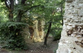
Our starting point is the village of Domoušice and the Domoušice Railway Station crossroad sign, near the local railway station. From here we will follow the green signs toward "Pod Džbánem“ (3.5 km). (Under the Pitcher) Gradually we will pass through the entire village, where we will see a beautiful Baroque chateau built in 1714 (now owned by the Forest Management Office) and also the late Baroque Church of St. Martin. We will go along the railway track between hop-gardens and woods, until we come to the road and crossroad sign for Pod Džbánem. From here we may "jump over" to the opposite hill to see the ruins of the once mightycastle known as "Džbán" (the Pitcher) which is now almost entirely covered by overgrown vegetation. We do not know the castle's original name. Neither do we know who built it. But we know that it was located inside a prehistoric castle grounds. The castle floor plan was shaped as a polygon and its base was about 60 m long and 45 m wide. The dimensions of the whole fort is about 200 m x 300 m. The castle was apparently built to watch over the ravine.
We will continue to follow the yellow signs toward "Mutějovice Railway Station" (0.5 km.) From theMutějovice Railway Station we will visit the mysterious "Kounovské kamenné řady“ (Kounovské stone rows). We may either follow the yellow signs for 2 km or we may take the nature trail that is shorter (1 km) which will teach us about all of the details related to the historical and natural attractions of this locale. Kounovské kamenné řady are located on a vast rocky plateau. To get there, we have to undergo a steep climb /2-3/. Ancient inhabitants of this land arranged stones – quartz boulders in 14 parallel rows from the north to the south. Most likely these boulders were brought here from far away. Today we see only incomplete rows with fewer stones hidden in the dense forest. In the past though, these rows included tall boulders – steles, but these were already removed by neighbouring farmers. In total, we have registered 2239 stones, the longest row is 450 m long and the distance from the first west row to the easternmost large stone is 302 m. The importance and purpose of this work has not yet been clarified, but it is certain that this work is unique and it is the only sight of this kind throughout Central and Eastern Europe. From the stone rows our educational trail will take us to the Na rovinách (On the plains) crossroad, where we will see a picturesque hunting cottage. Approximately 500 m to the right aside the blue sign, we may see remnants of ditches and stone ramparts, which were part of the inhabited fort from the stone age. A linkage or relationship between the fort and the stone rows is assumed, but has not been proven. From the "Na rovinách" crossroad we will follow the yellow sign towards Výrov Hill. After following the yellow signs for 7 km we arrive at our destination. From the upper plain of Roviny (Plains) we will go down, pass the road and climb the Špičák (Spike) Mountain slope and then take a downhill walk towards a cottage colony near the village of Nečemice. From Nečemice we continue climbing for 2 km until we reach the Výrov crossroad. To get the top we have to overcome another 500 m while still following the red sign. At first glance the top, at an altitude of 509 m AMSL (above the mean seal level), looks ordinary But a more detailed inspection will reveal to us that the top plateau is rising significantly above the surrounding terrain and that it is separated by steep cliffs. We may also see remnants of an ancient settlement here. Our steps will now take us along the green sign to "Pnětluky" (5 km) and to the ruins of "Pravda" (the Truth) Castle (6 km). Until the end of the village of Pnětluky we continue mostly downhill but almost immediately after the village we must undergo our last 1 km long steep climb, all the way to Pravda Castle. The first written record about Pravda Castle dates back to 1523 but archeological findings have proven that the castle existed already in the 14th century. However, the "builders" of the castle remain unknown. Also the inhabitants of the former fortified castle grounds where the castle was built remain unknown. Almost all of the castle walls, sections of buildings and underground foundations have been preserved. At the end of our trip we must overcome 2 km of mostly downhill walking, while following the red signs, which will take us back to theDomoušice Railway Station. Total length 21.5 km


