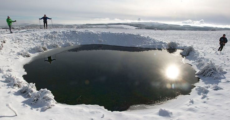
Our starting point is an important winter sports and recreation centre Nové Město v Krušných horách (New town in the Krušné Mountains). From here we shall follow the red sign towards Vrch tří pánů (Peak of the Three Lords) (2.5 km). A comfortable ride on an almost flat plain will take us to Vrch tří pánů (Peak of the Three Lords), where we find a small resting place. We continue to follow the red sign towards "Vilejšov – abandoned village" (3.5 km) and "Flaje – abandoned village" (7.5 km). Then we take a downhill ski, which will reward us with many beautiful views and will end on the bank of the Flájský Brook. Here we should cross the brook and continue to follow the tourist sign. However, if there is no bridge (the last bridge was destroyed by the flood in 2002), do not try to attempt to cross the brook during winter. Flájský Brook, although very beautiful, can reach depths of 1 m and it is very cold. Just follow the left bank until you see a forest trail on your left side. Take this trail uphill for about 100 m and you will see a green tourist sign, which will take you to nearby Vilejšov – an abandoned village. We continue to follow the red sign towards Flaje - an abandoned village (4 km) and Horní Ves (8 km). A short distance behind the crossroad we will see a functional bridge which will take us over to the other side. The following 4 km go through slightly hilly countryside, where observant tourists will discover a lot of impressive scenery. When we reach a wooden cross erected in commemoration of the abandoned village of Fláje, we will be almost there in Fláje – abandoned village. We still follow the red direction towards "Horní Ves – spring" (4 km) and Český Jířetín – public swimming pool (6 km). After about 2 km of moderate climbing /1-2/ we will see two eye-catching monuments. One is the Puklá skála (Cracked Rock) and the other one is a human creation. The 47.5 m high Flájská (Fláje) Dam. The dam was built between 1954 - 1963 and it is the only pillar dam in the Czech Republic. After a while we will begin to descend /2/ down to Horní Ves - spring. If you wish to see the former timber-processing village of Český Jířetín, where you may also purchase refreshments, you must continue for another 2 km. If you decide to pass then go straight ahead and follow the yellow sign towards "Žebrácký roh" (Beggar's Corner) (2.5 km) and "Pastviny" (4.5 km). A smooth climb will take us to Žebrácký roh. From there we continue on open meadows and through an avenue of fruit trees, reminding us of the former busy life that existed on these plains in the past. Ruins of various settlements near Pastviny will fill us with nostalgic feelings. From this crossroad we continue on the Krušnohorská ski trail (no tourist sign) towards Nové Město (6 km). Our journey continues through the avenue to the foothills of the Nad křížkem Hill (Above the Cross Hill), where, if the weather allows it, you can enjoy spectacular views. We will keep going straight ahead until we see another ruined house with a transmitter. Here, the Krušnohorská ski trail turns to the right and continues straight through Grunwaldské vřesoviště (Grunwald Briar), which is a typical representative of a highland-type peat-bog with an average depth between 4.5 - 5 m. After we pass the Rovina (Straight) Peak we start descending slightly, until we reach Nové Město, where our trip ends. Total length 24.5 km or including a visit to Český Jířetín it is 28.5 km Other recommended starting points: Český Jířetín on the red sign road towards "Horní Ves – spring"


