


Select from ...
-
 Explore
- Castles and ruins
- chateaus
- churches (religious monuments)
- museums and galleries
- vernacular architecture
- industrial
- lookout towers
- educational trails
- Zoo
-
 Relax and Sport
- spa and wellness
- theatres and cinemas
- water parks and swimming
- fun for children
- sport venues
- indoor and outdoor rock climbing walls
- Golf
- ski areas
-
 Services
- accommodation
- meals
- craft breweries
- wineries
- rentals
- transportation
Dolní Poohří
Krušné hory
České Švýcarsko
České středohoří
Transport method:


Search results:
Across the former Gabriela Iron Mill to the valley of Telčský (Telč) Brook.
The starting point of this winter trip is a place called Kalek - Penzion (Guesthouse) U Vítků. From here we will follow the green tourist sign towards Malý potok (Small Brook) (4 km) and Gabrielina huť (Gabriela Iron Mill) (8 km). However, if this scenic route going along the Načetínský Brook is still not repaired after the flood damage that occurred here in autumn 2002, we must use an alternate road and after few metres turn to the right and follow the ...

Cross-country skiing trip to the rock town and
The starting point for this trip may be the parking lot near the Swiss house in the village of Sněžník. On your way to Sněžník you may stop in the village of Tisá where you may admire the winter beauty (without skis) of the rock town known as the Tiské Walls. Near the parking lot you will find a tourist crossroad sign for Hřebenová bouda (Ridge Hut). From here we will follow the direction towards "Děčínský ...

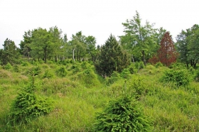
Interesting tourist sights around Kyjov and Doubice
. You may begin this trip in the recreational village of Doubice, where you will see many traditional folk houses located along the edges of vast forests. We will start near an old lodging house and restaurant called Stará hospoda (Old Pub), on the road crossing the Doubický Brook and then going slightly uphill /1-2/ and above the village. On your right side you will see a classicist church built between 1811 and 1814. The green tourist sign will join our road in the ...

Lipová - Velký Šenov - Mikulášovice
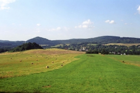
The entire trail is 16 kilometres long and has two ends. The road quality is very good. Only here and there you will find small hills, which will only make your trip a little bit more interesting. The trail starts at the state border crossing Lipová - Neugersdorf and runs through the village of Lipová until it reaches Velký Šenov. The trail then continues towards Mikulášovice, where it crosses trail No. 3041 and splits into two roads. One goes ...

Dolní Poustevna - Vilémov - Mikulášovice - Tanečnice (Dancer) - Brtníky - Mikulášovice - Vlčí Hora - Zahrady - Dymník - Rumburk
The entire trail is 30 kilometres long. It runs between two state border crossings, and between two viewing towers. It is not a demanding trail at all plus you will be walking on a good road going slightly uphill. The beginning of the trail is at the state border crossing Dolní Poustevna - Sebnitz as well as the beginning of trail No. 3043. You may also join the trail from the local railway station. The trail continues through Vilémov and Mikulášovice, ...
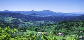
Jedlová - Malý Stožec -Chřibská - Horní Podluží - Studánka - Krásná Lípa - Kyjov
The entire trail is 21 kilometres long. The entire trail overcomes only a small difference in altitude, but it goes through beautiful countryside. It begins, together with the trail No. 3015, at the railway station of České dráhy (Czech Railways) called Jedlová. At Tolštejnská cesta (Tolštejn Road) it turns to the left and passes Malý Stožec and continues towards the railway station called Chřibská. However, before it reaches ...
Doubice - Zadní Doubice
The trail is 9 kilometres long and even though it is a short trail, it belongs in the "very difficult" category. It begins near the turn to the side road No. 3029, located between Doubice and Kyjov. Even though the road is covered with asphalt, do not be fooled. After 4 kilometres you will encounter a sharp descent which will take you to a gravel road. Beware of danger. Use extra caution. At the end of the descent the trail ends. At the state border crossing Zadní ...

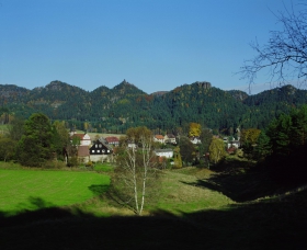
Vysoká Lípa - Šaunštejn - Tokání - Chřibský Castle - Doubice - Kyjov - Vlčí Hora
The entire trail is 17 km long and most of it goes along the National Park border. It is rather a hilly route, but it goes through beautiful landscape, well worth admiring. It begins in the village of Vysoká Lípa and continues on Česká silnice (Czech Road) around Šaunštejn Castle. Under Ptačí kámen (Stone Bird) turns into Táborový důl (Camp Mine), which will take you after a short climb to Tokání. After ...
Chřibská Town Square - Purkartický (Purkratice) Forest
Chřibská Square X 1604, 3903 - Spravedlnost (Justice) (? 0.5 km) Doubice 4 km - Bor 7 km - Úzké schody (Narrow Stairs) 9.5 km (0.4 km pass-through turn) - Na Tokáni 10 km X 1631 - Purkartický Forest 11.5 km X 0331

Česká Kamenice, town square - Rybniště
Česká Kamenice, náměstí/square X 1604, 1640, 3942, 3938 - Česká Kamenice (ŽST- railway stop) 0.5 km - Zámecký vrch (Chateau Hill), castle ruins 1.5 km ( 0,6 km) - Kamenický Šenov, lower part 4.5 km - Kamenický Šenov, náměstí/square 7 km - Panská skála (Lord's Rock) (Organ) X 1634, 6959 TZT district of ČL 8.5 km - Horní Prysk 11.5 km - Mlýny (Mills) 15 km pod ...
